


Tuesday, May 28, 2019
View the entire Google Web Album
This ride heads eastward from Sacramento County for a clockwise scenic backcountry loop along White Rock Rd into El Dorado County to Latrobe Rd. The route crosses over Cosumnes River into Amador County for the return westward on Jackson Rd to Rancho Murieta followed by a roll along Scott Rd.
Begin this ride from Village Green Park and head east on White Rock Rd. White Rock stretches five plus flat miles to Grant Line Rd.


White Rock continues eastward on flat-rolling terrain through the beautiful expansive valley out past Prarie City Rd and E Bidwell to Placerville Rd.


White Rock crosses over the RR tracks as it continues with a short gentle climb up to its highpoint followed by a drop into El Dorado County to Latrobe Rd.


Latrobe runs SE past the residential suburban homes and business park around El Dorado Hills.


The road exits town with a gentle climb followed by a sweeping descent through the gorgeous backcountry.


After crossing Deer Creek, Latrobe Rd continues on gently rolling terrain alongside the SP RR tracks to the town of Latrobe.


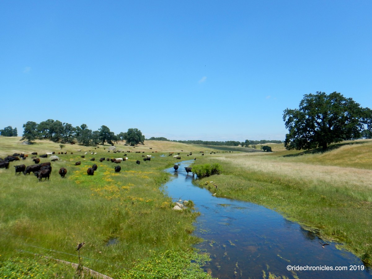
The rural back road winds through the high valley before crossing over Cosumnes River into Amador County.


Latrobe continues with a gradual climb followed by a descent into the open valley to Old Sacramento Rd.


Head SW on Old Sacramento Rd to the Jackson Rd/CA-16 junction.


Jackson Rd/CA-16 turns westward for a flat run through the valley into Sacramento County to the town of Rancho Murieta.


The route heads northward on Stonehouse Rd; the flat terrain leads up to a short steep 12-14% climb before dropping down to a T junction at Latrobe Rd.


Turn right and head north on Scott Rd for 9.5 miles, the terrain begins with a series of rolling hills followed by a drop into the open valley meadows.


This beautiful country back road continues across the gorgeous valley to the T junction at White Rock Rd.


Reverse the route on White Rock Rd for the return to Village Green Park.


Garmin Stats:
58.75 Miles with 2602′ of elevation gain
Max elevation: 819′
Max grade: 16%
Terrain: Flat-rolling with some low hills.
Weather: Partly cloudy morning with afternoon sun. Temps ranging from the high 50’s to the mid 80’s with SW > NW winds.
View the interactive RGPS route map & profile

Follow this route for today’s ride:
